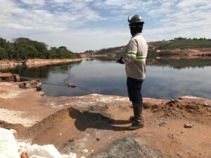
Geological mapping is a type of survey carried out by professionals to investigate rocks located in established areas and the presence of deformations, faults, fractures and other geological information. After this study, a geological map is created that locates and gathers information from the data obtained.
This is done for mineral exploration, in order to find out if the area has any good to be explored.
The three methods for geological mapping
1 – The geological map on a regional scale has a limit, called regional recognition, it is done in scales with a limit of 1:250,000 (1cm = 2.5km). It is the maximum limit of work.
2 – Semi Detail Map: It has the same limit as the regional scale map of 1:250,000. is processed on the effectiveness of geology in works that are intended to detect and map the geolody of a certain location.
3 – Detail Scale Map: This type of detail mapping is performed in another scale that oscillates from 1:10,000 to 1:2,000, sometimes it is used in smaller scales than that. When this occurs, it is to produce the mapping of trenches, colluviums with potential mineralization or delimitation of ore bodies with potential mineralization.
Main geological mapping techniques
There are numerous geological mapping techniques, the three most popular are:
1 – Walking perpendicular to the trend
This is a technique generally used for all scales, starting with the regional ones and going down to details, and its main purpose is to detect lithologies and organize the stratigraphy and main structures of the area.
2 – Walking parallel to the trend
This geological mapping method must be exclusively operated in semi-detail and some-detail surveys. It is intended to examine the continuity of lithologies, some errors and general structures.
3 – Mapping according to baseline and trails
The last geological mapping technique used in detail scales, caused by in-depth topographic surveys in a certain specific area. Therefore, the bite is wide enough to perform and carry out the mapping. The rocks and outcrops are allocated after the pickets installed by the topography team.
What is a geological map
The geological map is generated after the geological mapping, where the geology professional implements all field information, about structures, about rocks and occurrences of ores, among other studies that are also common. In addition to the map, the geology professional will unify what he saw in the field study with the documentation of that certain region.
Before producing a geological map, it is necessary to follow some essential steps:
– Analyze area photographs, satellite images and also aerial geophysical data.
– Do a great planning of the area beforehand, prepare a pre-field map, delimit a certain area to be studied and the accumulation of points to be executed.
– Essential to carry out fieldwork, which is the aforementioned geological mapping.
– Primordial to prepare and establish all data collected (lithology, structures, petrographic description, etc.).
– Every time it is necessary, another final geological map and another technical report must be drawn up, so that no detail is missing.
After all the techniques it is necessary to create the final geological map, the geology professional usually operates in some software with geographic information system (GIS).
In this way, he manages to interfere with his records in the field study and the images of the studied rock and outcrop. Field coordinates can be positioned on a GPS.
After that, the last obligatory step is to carry out a detailed mapping, which the geology professional can easily achieve when arriving at the mapping of the rock, as the mapping had already been properly carried out.