Bathymetry is the study and analysis of underwater topography, including rivers, lakes and other bodies of water. To carry out this activity, it is very common to use echo technologies, such as sonar, which are used by animals such as dolphins and whales to detect obstacles without seeing directly. Bathymetry is a compound word from the Greek words bathos (depth) and metron (measure).
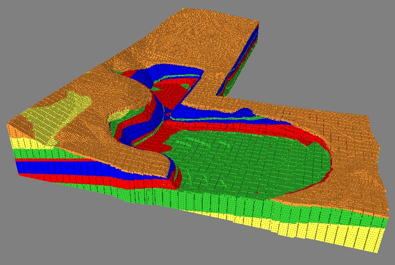
Echobathymetry is a branch of bathymetry that uses echo-based technologies. In addition to measuring depth, bathymetry also seeks to map the topography of the submerged area with as much detail as possible.
Echobathymetry is a branch of bathymetry that uses echo-based technologies. In addition to measuring depth, bathymetry also seeks to map the topography of the submerged area with as much detail as possible.
How is bathymetry performed?
In the past, bathymetry was performed by measuring specific points in the submerged area with submerged cables. However, this process was time consuming and error prone due to river currents that can affect measurements.
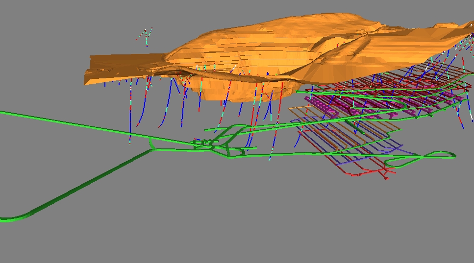
Currently, bathymetry is performed more quickly and accurately thanks to the use of advanced technologies such as computing, digital sensors, satellites and georeferencing. Some examples of equipment used in modern bathymetry include sonar sounders, depth sensors, and autonomous underwater vehicles.
Bathymetry has many applications.
Bathymetry is important for many areas, including geology, engineering, marine biology and even the military. Bathymetric maps are valuable tools for understanding the distribution and characteristics of marine habitats, as well as for assessing the impact of human activities, such as fishing, on marine life.
Bathymetry is also used to locate natural resources such as oil or minerals, or to carry out scientific research on the seabed. In addition, it can be used to monitor sea levels and predict the impact of weather events such as hurricanes and floods.
In a military context, bathymetry is used to locate obstacles or underwater mines, as well as to carry out surveys on the seabed in strategic areas. Finally, it can also be used in rescue operations, to locate missing objects or people in bodies of water.
In summary, bathymetry is a valuable tool that uses echo technologies to analyze and understand the underwater surfaces of rivers, lakes and other bodies of water. With the use of advanced technologies, bathymetry is capable of providing accurate and detailed information about the topography and depth of submerged areas, which is of great importance for several areas of science and technology.