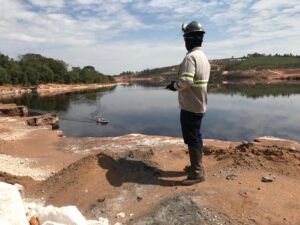
Topography services are offered by specialized companies and include various activities such as surveys and measurements, consultancy, project preparation, measurements and referencing.
The companies have certified professionals to work in these services, including architects, engineers, urban planners, geologists, among other people responsible for the preparation and execution of projects in the area.
Land assessment is a fundamental part of topography services. The terrain features are identified and observed in detail, whether natural or artificial, as well as the shapes of each one. This activity aims to determine whether or not the land is suitable for receiving the infrastructure.
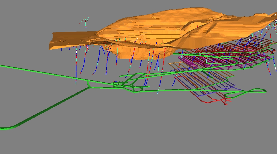
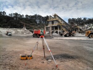
An example of a topography service are topographic surveys, which can be of different types: traditional, cadastral, altimetric, planimetric, georeferenced, etc. For these services, there is a demand for different equipment.
Services
Analyzing in detail among the services provided by qualified companies, one can find georeferencing of rural and urban properties, consulting on environmental licensing and land regularization, earthworks, surveying, aerial photogrammetry, allotment and dismemberment, rectification of administrative areas, among others.
The client contacts the companies in advance to learn more about the services offered and to make a budget. Next, four of the main categories of services provided will be discussed in general.
Georeferencing involves the use of equipment that has a satellite navigation system to carry out a survey aimed at recording data to determine the limitations and characteristics of the construction.
Another important service is the earthworks project, which consists of preparing studies of the alternation of movement of earth volumes in a specific area. This procedure is usually adopted in civil construction and architecture works.
There are also surveying services, which make a graphic representation of the property, aiming to specify the measurements, limits and relief of the area, considering all the relevant legislation.
The aerial photogrammetry service aims to carry out a survey of the main characteristics of the surface. To this end, unmanned aircraft are used, enabling the mapping of a larger area in less time.
Importance of topographic services
The adoption of topographic services provides a detailed analysis of the terrain through different processes, making it possible to learn more about the area in which it will be built. From this analysis, it will be possible to define the limits of the construction, better use compatible with the natural resources and adequacy to the current legislation.
The topographic services will provide the identification of the characteristics of the relief where the structural bases of the construction will be installed, which is essential for the prevention of failures in the building. Therefore, this is an essential step for the engineer, but it also provides useful information for professionals in other areas, such as architecture, environmental engineering, among others.
Use of drones in surveying services
The adoption of new technologies has been a means of optimizing surveying processes. An example of this is the use of drones, which bring more efficiency by mapping a larger area in less time. The drone is still able to reach areas that are difficult for workers to reach, ensuring full coverage of the terrain.
Investment in technology is cost-effective in the long term, as in addition to greater efficiency, there is a reduction in operating expenses.
Other advantages made possible by using a drone are detailed records of the terrain in photos, the possibility of modeling the terrain, greater precision in determining the relief of the location, facilitating the identification of risk areas, etc.
Therefore, the use of drones offers cost reduction, speeds up the surveying process and enables a more detailed and accurate data collection.
Conclusion
Topographic services involve a set of procedures that are essential to ensure knowledge of the main features of the terrain, safety in the design and construction of the building, and compliance with legislation.