Geotechnical mapping ranges from the action to the recording of objective geological observations, in the middle of the field. In order to create a geotechnical map, some information is necessary: it must contain some data related to the predominant rocks in specific areas, such as contacts with lithologies and geological structures, surface deposits and also faces topographical and geomorphological. Geotechnical mapping has several purposes, but most of the time it is focused only on mineral research.
Geotechnical mapping consists of several phases and it is necessary to have a method for presenting cartography for the planning and use of the territory on geological-geotechnical information. Another type of project is about building and assisting Engineering works in general, on the characteristic data of nature from a geological map. The geotechnical map, on the other hand, covers some data related to the nature of a geological map and includes compatible data on attributes and particularities of a soil and the subsoil of a certain territory to lead to an evaluation of its behavior, it also has the ability to predict the conduct and plausible geological-geotechnical difficulties when taking advantage of engineering projects.
The content of geotechnical mapping

The material for detailing the information on a geological-geotechnical map is in charge of the scale, purpose and relevance of the different geological-geotechnical factors, the description, knowledge about its characteristics, the information made available and the presentation of a specific technique.
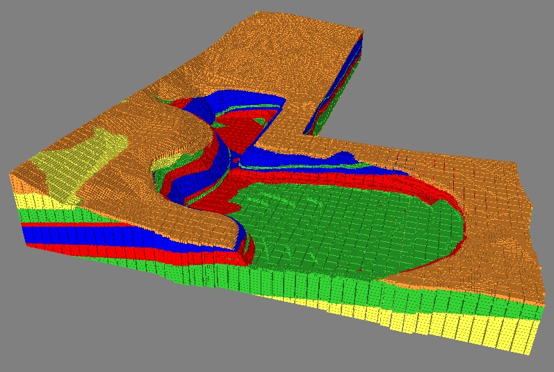
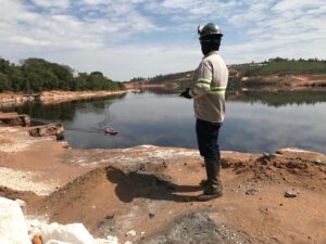
Generally speaking, there are small-scale maps that are less than 1:10,000, medium-scale maps are between 1:100,000 and 1:1000, and large-scale (local) maps are those greater than 1:10,000. On the other hand, large-scale ones are those greater than 1:10,000. There are analyzes on the dam sites and mapping of the excavated fronts, geological maps with scale detail between 1:5,000 to 1:1000. receive this information from geological plans or geological-geotechnical plans.
No matter the map model, there are certain rules and a fundamental amount of essential knowledge to be followed; among them are:
- Topography and Toponymy;
- Distribution and description of geological units;
- Thickness of Soils;
- Surface formations and weathered rock;
- Discontinuities and Structural data;
- Geotechnical classification of soils and rocks;
- Properties of Soils and Rocks;
- Hydro-geological and geomorphological conditions;
- Dynamic processes;
- Existing previous investigations;
- Geological hazards (Vallejo et. al., 2002).
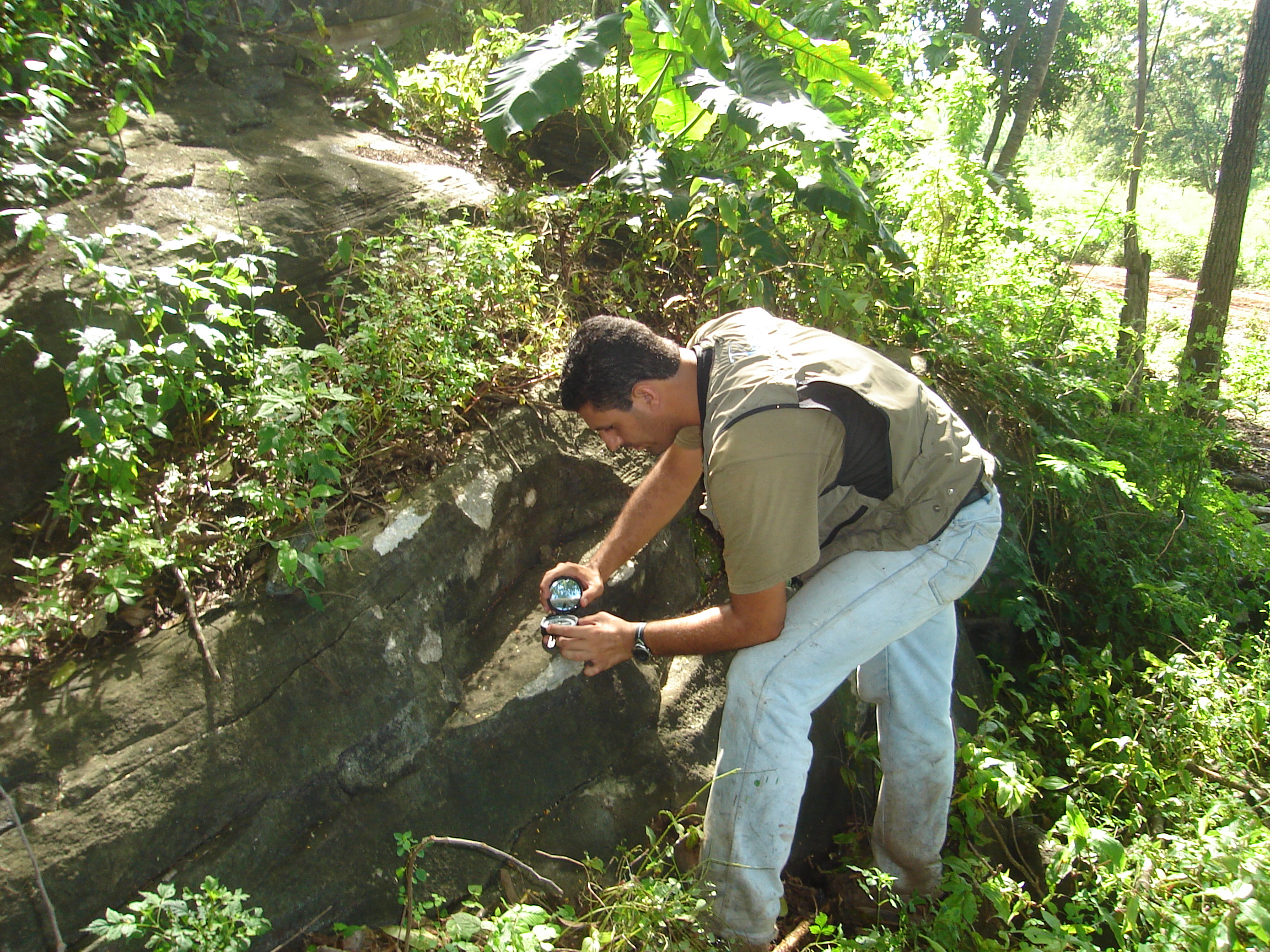
About the analysis there is the direct callin loco and it is totally essential, it cannot be replaced by any hypothesis and it becomes simply essential for the execution of a project based on civil construction. A famous geologist named Haakon Fossen once said that “It is difficult to overstate the importance of traditional field observations of deformed rocks and their structures. Rocks contain more information than we would ever be able to extract from them, and the success of any physical or numerical model rests on the accuracy of field observations. The direct approach to rocks and their structures, without filters or interpretations by specialists or computer programs, is still invaluable.”
The conclusion we have about geotechnical mapping is that it is a clearly meticulous study that requires the geologist's skill in defining the soil and rocks, and it is also necessary to carry out a field study so as not to leave anything out of plan.